September 9, 2022
Stearns Weaver Miller News Update
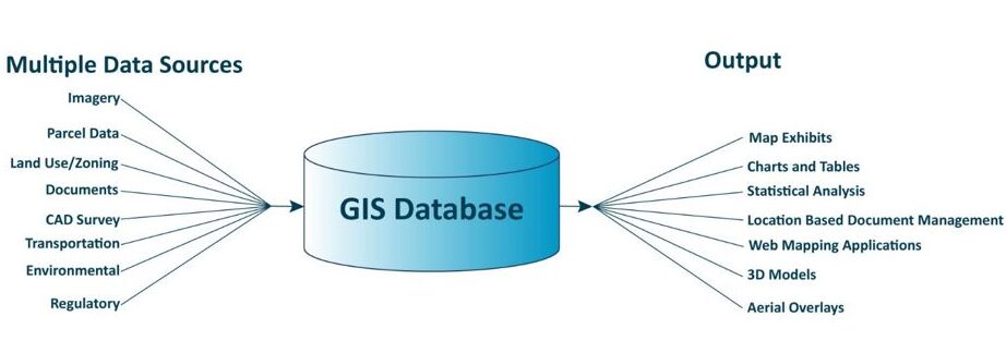
Our in-house team is at the forefront of providing mapping and Geographic Information System (GIS) services and is continually evolving to adapt this cutting edge technology to support all practice areas and client needs. We collaborate daily with our attorneys, in-house planners and consultants statewide to integrate legal and policy analysis with advanced technical capabilities.
GIS is a toolkit that enables us to efficiently and effectively visualize, analyze, and manipulate information tied to specific locations. With GIS tools, we can expose deep insights into diverse subjects by transforming complex data into interactive maps. It helps us to discover trends, understand geographic patterns, and uncover relationships.
The power of GIS lies in its ability to shed light on intricate interactions, empowering us to gain a multi-layered understanding of our world. GIS allows us to augment and manipulate data, enriching it with additional information to further enhance our comprehension and shape compelling narratives.
Research opportunities to extend the expiration of permits due to recent Executive Orders declaring a state of emergency in Florida.
View Tracker
Developers can help maximize financing and tax incentives using this tool that “stacks” areas with multiple overlays including Community Redevelopment Areas, Qualified Opportunity Zones, Brownfield Areas, Difficult to Develop Areas and Qualified Census Tracts.
View Tool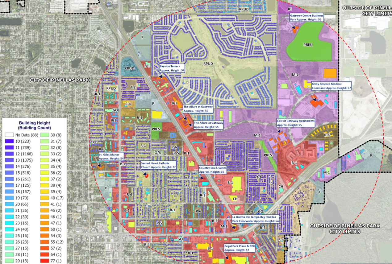
Using LiDAR data we can evaluate the tallest commercial and residential structures within one mile to submit with LLA applications.
View Map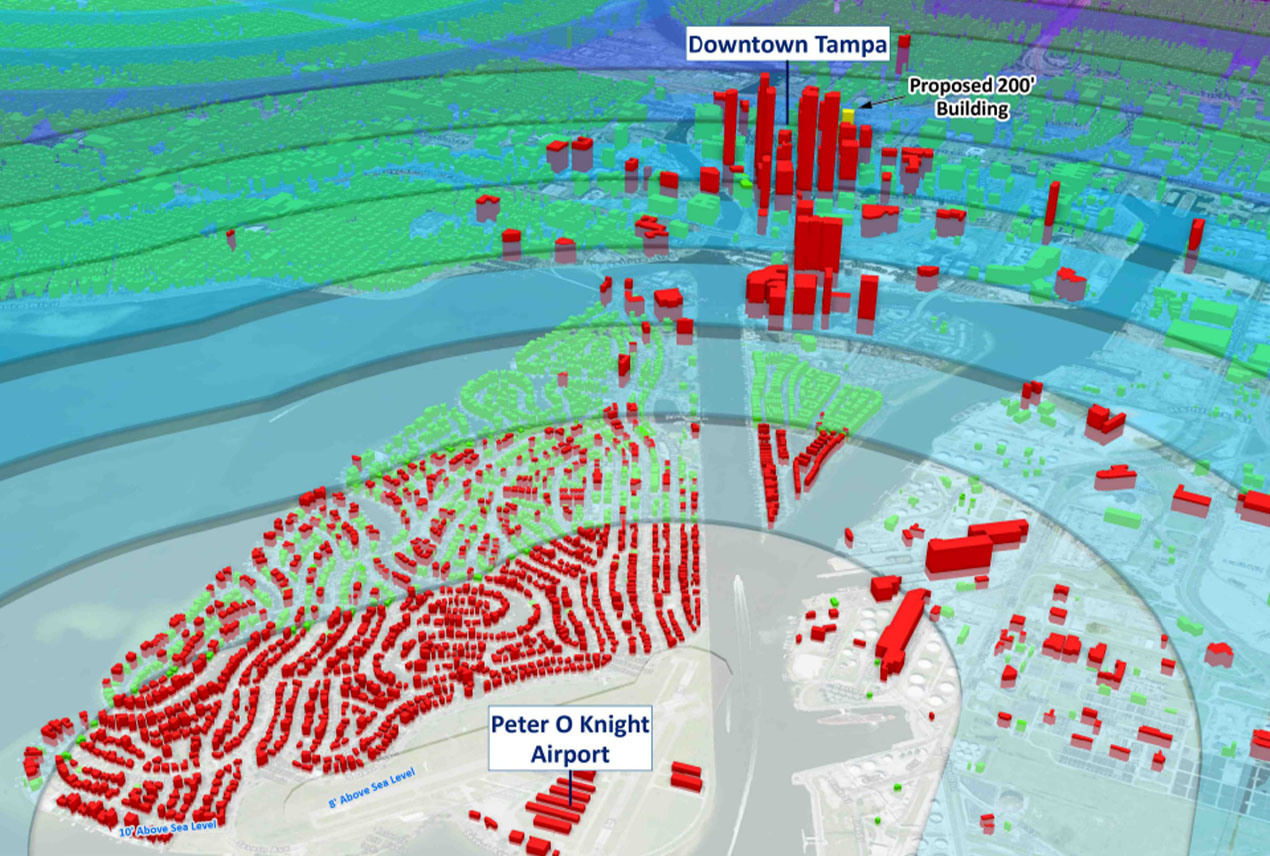
Using LiDAR and DEM 3D elevation surface analysis, we can approximate proposed project and nearby building height.
View Example
Constraint avoidance analysis mapping. Incorporates environmental and existing land use factors to predict the most likely route for three new tolled road corridors through rural Florida.
View Map
In-house parcel database that seamlessly incorporates all 67 counties comprised of over 10.5 million property records. Highly advanced data manipulation software produces an updated data layer in slightly more than two hours.
View Map
Assist small municipalities by using advanced GIS tools to create models for planning guidance.
View Map
Assist local governments to create custom webmaps to assist in permitting and planning guidance.
View Tool
Weekly statewide analysis that presented positive COVID-19 cases trends in a much higher resolution than was available elsewhere.
View Map
